About Project
Project "Views of Olomouc" originated as an output master thesis at the Department of Geoinformatics, Palacky University in Olomouc in 2010.
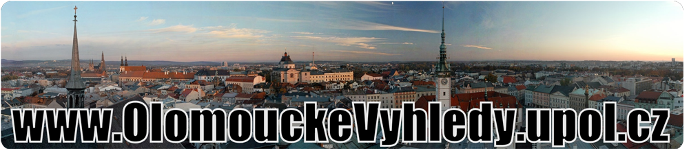
It's goal is to attractively introduce the most important observation points in Olomouc district to the general public .
Visibility analysis
Visibility analysis, or Viewshed is common function of almost all GIS systems. The aim of this thesis is to find out the best sollution, how to compute viewshed for ORP Olomouc and ensure the best way of visualisation of the results.
The first step to analyze the visibility is making the high quality Digital Terrain Model, the choice of the best interpolation method and the subsequent addition of vegetation and man made structures layer.
Visibility calculation is contained in a large amount of software, but not all are able to compute the visibility for a large area, so the choice of software was also very important.
Visualisation
Currently there are many ways how to transmit the analysis results to the target user. One of them is the use of Google Earth. Thesis deals with the possibilities of exporting the output from the visibility analysis from ArcGIS system to Google Earth. Important part is to optimize the size of the resulting layer using various methods of generalization so that the resulting layer is sufficiently precise and not too voluminous at the same time.
Project also explores the possibilities of enrichment of visualization with multimedia content which can be for example 3D models of buildings, photos, videos or spherical panoramas as we know from Google Street View etc.
Outputs
Output is an interactive application - KMZ file executable in Google Earth or Google API.
Both these methods allow an easy access to data about visibility of the most observation points in the district of Olomouc.
Outputs are in section Download (Google Earth version) or directly in browster window in API section. Or you can watch videos in Samples section.